Flores Island: Waterfalls, Lakes and the Best Walks in the Azores' Greenest Corner
Flores is the westernmost island of the Azores and of Portugal; the next landmass to the west is North America. It is also one of the wettest, greenest and least crowded islands in the archipelago. Rain that falls on the high interior feeds crater lakes, drains through deep valleys and tumbles down the cliffs of the west coast as dozens of waterfalls, some of them visible straight from the road. The island's name means "flowers", and in summer hydrangeas line many of its lanes. Together with neighbouring Corvo, Flores is a UNESCO Biosphere Reserve. This guide focuses on the walks and viewpoints that most visitors come for: Poço do Bacalhau, Poço da Alagoinha, the Rocha dos Bordões near Fajãzinha, and the twin lakes Lagoa Comprida and Lagoa Negra, followed by practical tips on getting there.
Why Flores Is Made for Walkers
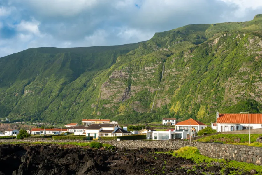
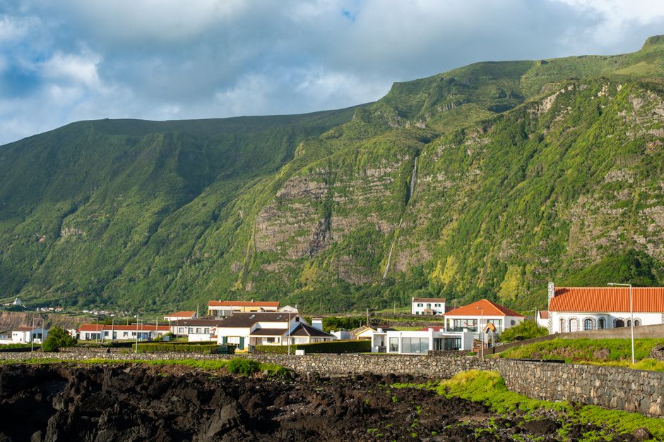
Flores is small enough to explore in a few days, yet its landscape is surprisingly varied. The interior is a plateau scattered with volcanic craters, many of them holding lakes. From there, streams run west and north towards the Atlantic, carving steep valleys and dropping over the sea cliffs. The villages of the west coast, Fajã Grande and Fajãzinha, sit on small coastal platforms known as fajãs, backed by walls of green that are laced with waterfalls after rain.
The island's main towns are Santa Cruz das Flores, where the airport is, and Lajes das Flores. Most of the best-known waterfall scenery lies on the west side, so many visitors base themselves there or drive across for the day. Because the climate is oceanic, the weather can change several times in an hour. That is part of the character of the island, and it is also why the waterfalls are so reliable. If you want a broader overview of the Azores before narrowing in on Flores, our guide to the ten best Azores hiking trails is a useful companion, and the article on the secret islands of Flores and Corvo puts the western group in context.
Many of the island's walks are waymarked as official hiking routes (the Azores uses a network of short and long marked trails). Route lengths, conditions and even access can change after storms, so always check the current status with the local tourist office or the official Azores trails information before you set out. Some marked trails in the archipelago require online registration, so it is worth confirming whether that applies on the day.
Fajã Grande and Poço do Bacalhau
Fajã Grande is often described as the westernmost village in Portugal, and it is the natural base for the best-known waterfall on the island, the Poço do Bacalhau. The name translates as "cod pool". Here a stream drops over a rock wall into a pool, surrounded by dense vegetation, in a setting that looks closer to a tropical valley than to the North Atlantic. The waterfall is reached on foot from the Fajã Grande area, and the walk is generally considered short and suitable for most reasonably fit walkers, although there are muddy and slippery stretches.
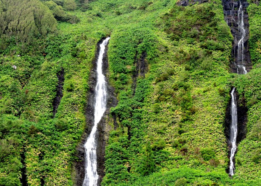
Practical tips for Poço do Bacalhau:
- Wear shoes with proper grip. Rock near the water is slippery.
- Go early or late in the day if you want quiet, as the site is popular with day visitors.
- Check the exact route and expected walking time locally; do not rely on rough estimates from old blog posts.
- Take a light waterproof jacket, since mist from the falls and sudden showers are common.
- Take your rubbish with you and stay on the path to protect the vegetation.
Poço da Alagoinha: Cascades and a Quiet Pool
A second natural highlight in the same part of the island is the Poço da Alagoinha. Photographs usually show a cluster of waterfalls spilling down a green wall into a clear pool, with ferns hanging over the edges. It is smaller in scale than some visitors expect, yet it has a magical, enclosed feel, and it tends to be the kind of place where people sit for a while rather than rush on.
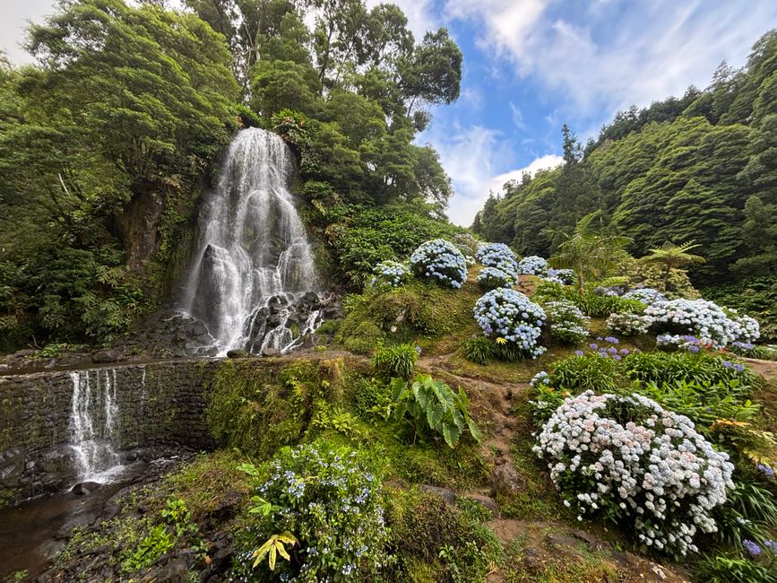
If you want to swim, remember that these pools are fed by cold mountain water and have no lifeguards, and that water levels can change quickly after rain. Never jump into pools you have not checked, and avoid entering the water when streams are running high. Many visitors are content to dip their feet and enjoy the setting.
For travellers who like to chase waterfalls across the whole archipelago, our article on Azores waterfall hikes covers more of them across the other islands.
Fajãzinha and the Rocha dos Bordões
A few minutes along the west coast from Fajã Grande lies Fajãzinha, a quieter village of stone houses and small terraces. Above it rises one of Flores' signature sights, the Rocha dos Bordões. This is a cliff of prismatic basalt, where lava has cooled into tall, vertical, organ-pipe-like columns. The formation is protected as a natural monument, and streams of water tumble over the rock face and between the columns, particularly in wetter months. The effect, with green vegetation clinging to the dark stone, is one of the most photographed views on the island.
Lagoa Comprida and Lagoa Negra
The centre of Flores is a high plateau where volcanic craters have filled with water. Two of the best known are Lagoa Comprida, the "long lake", and Lagoa Negra, the "black lake". They lie close together, separated by a ridge, and a well-known viewpoint allows you to see both from above. The contrast is striking: Comprida stretches in a long, elongated shape, while Negra appears darker and deeper, tucked into a steep-sided basin whose walls are covered in vegetation.
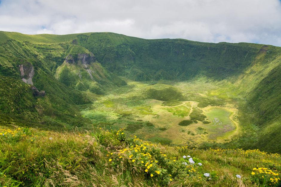
Other lakes nearby include Lagoa Funda and Lagoa Rasa, which are often visited together as well. The whole lake district is a place for slow viewing rather than long hiking, though there are marked walking routes that link several lakes for those with time and good weather. Because the plateau is high and exposed, clouds frequently hide the view. Patience pays off: it is common for fog to clear in minutes, revealing the water below, and equally common for it to close in again.
How to Get to Flores and Get Around
Flores has its own airport near Santa Cruz das Flores. Flights are operated by the regional airline connecting the islands, with links to other islands of the archipelago. Direct service from the mainland and from some other islands is not guaranteed in every season, so most visitors connect through another Azorean island such as Terceira, Faial or São Miguel. Timetables change from season to season, so check current routes before booking.
From Flores you can reach neighbouring Corvo, the smallest island of the archipelago, by a short flight or by a seasonal boat service. If you want to build a multi-island trip, see our complete island hopping guide for ferries, flights and itineraries.
On the island itself, the most flexible way to see the waterfalls, viewpoints and lakes is by rental car, which should be booked well ahead in summer because the fleet is limited. Taxis and local guides are also available, and guided tours can be a good option if you do not want to drive on narrow roads or if you want help with the trails. Roads are winding and sometimes narrow, with livestock and fog on occasion, so drive carefully. Distances are small, but travelling times are longer than the map suggests.
When to Go, What to Pack and Staying Safe
Flores is a year-round destination, but the experience differs by season. Summer, from roughly June to September, brings the best chance of stable weather, longer days and flowering hydrangeas. Waterfalls are often at their most dramatic in the wetter months, but access can be harder and daylight shorter. Spring and early autumn offer a balance between water flow and comfort. For a month-by-month view, read our Azores weather guide.
Safety is mostly common sense. Tell someone where you are going, keep to marked paths, turn back if rain intensifies and streams rise, and avoid slippery rocks next to falls. Rock falls can occur on steep cliffs, particularly after heavy rain, so do not linger beneath unstable slopes. Conditions and access rules change, so check before travelling.
Frequently Asked Questions
How many days do you need on Flores?
Three days allows you to see the main waterfalls, the Rocha dos Bordões and the lakes at an unhurried pace. Four or five days gives you time for additional walks, a boat trip or a visit to Corvo.
Which is the most famous waterfall on Flores?
Poço do Bacalhau, near Fajã Grande, is probably the best known, with Poço da Alagoinha also widely visited. Many smaller cascades can be seen from the roads, especially after rain.
Can you swim in the pools?
People do, but the water is cold, there are no lifeguards, and conditions change with rainfall. Swim only if you are confident and the stream is calm.
Are the walks difficult?
The best-known waterfall walks are generally short and moderate, with slippery sections. Some of the longer interior routes demand more fitness. Check the official description of each route.
Final Thoughts
Flores rewards travellers who slow down. A few waterfalls, a basalt cliff and two quiet lakes are enough to fill several days, and the mix of sea, valley and plateau means that the island never feels repetitive. Plan for changeable weather, check current trail and transport information before you travel, and leave space in your itinerary for the moments when the fog lifts and the landscape suddenly appears.