Faial Island, Azores: Complete Guide to Horta Marina, Capelinhos Volcano & the Blue Island
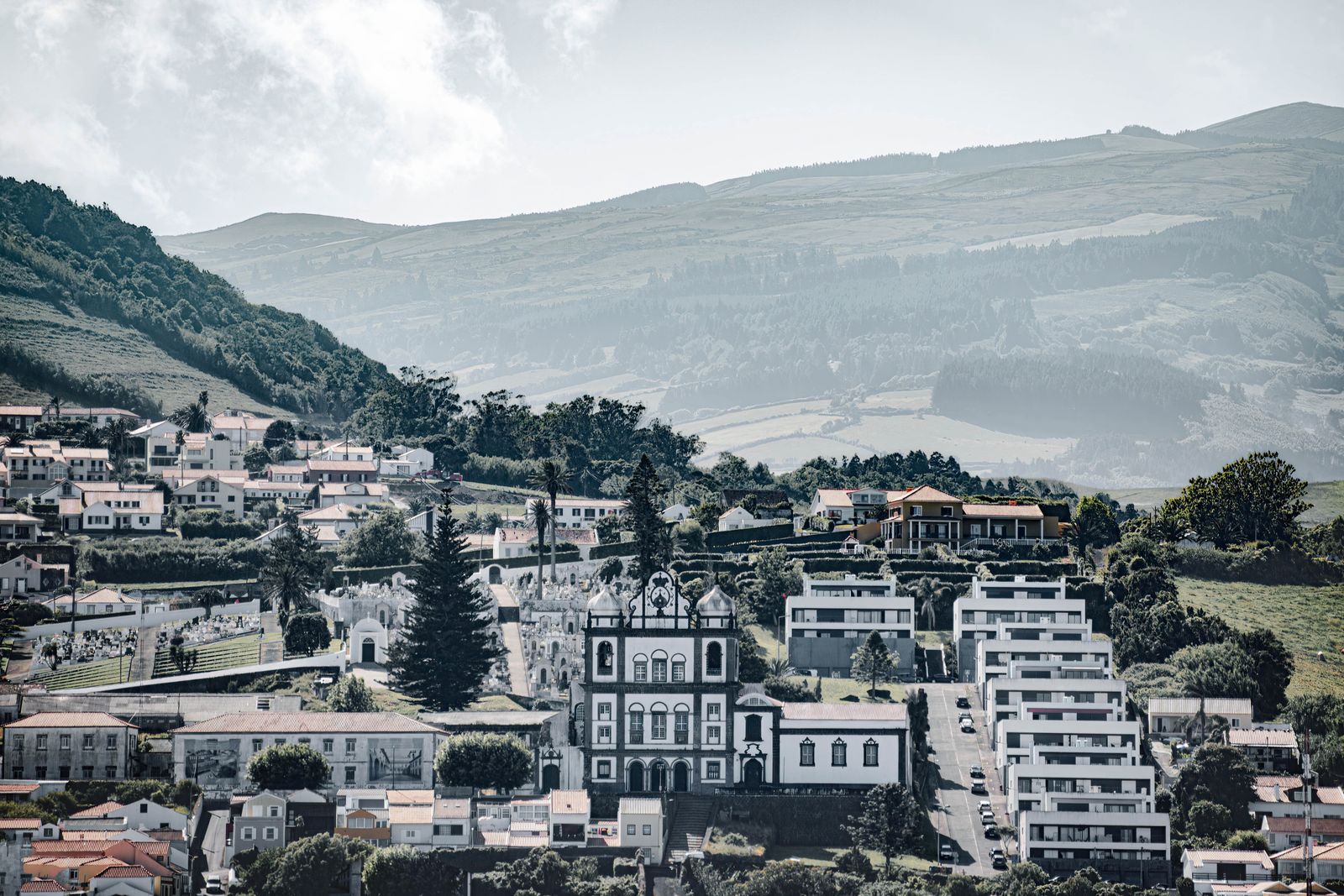
Sailors know Faial as the "gateway to the Atlantic." Azoreans call it the Blue Island, a nickname that makes perfect sense every summer, when thousands of blue hydrangeas bloom along the roads and stone walls that divide the island's pastures. Covering 173 km² and home to around 14,000 residents, Faial sits in the Central Group of the Azores and forms the famous "Triangle" with neighboring Pico and São Jorge. Few islands anywhere combine three things this rare: one of the most legendary sailing harbors on Earth, a volcano that rose out of the ocean less than 70 years ago, and a volcanic crater you can hike in a single afternoon. This complete Faial guide covers everything you need to plan your 2026 visit — from Horta's hand-painted marina to the underground galleries of the Capelinhos Volcano Interpretation Centre.
Where Faial Is: Quick Facts & Geography
Faial sits in the Central Group of the Azores, separated from Pico by a channel just 8 km wide — on clear days, Pico (mainland Portugal's highest peak at 2,351 m) dominates the horizon from almost anywhere along Faial's south coast. Together with São Jorge, these three islands form the "Triangle," one of the most visited and marine-life-rich corners of the archipelago.
- Area: 173 km²
- Population: around 14,000
- Highest point: Cabeço Gordo, 1,043 m (crater rim)
- Capital: Horta
- Ferry to Pico: 30 minutes
- Flight to São Miguel: around 50 minutes
Horta: The Mid-Atlantic's Sailing Capital
Horta isn't just Faial's administrative capital — for more than a century, it has been one of the most important meeting points in transatlantic sailing. Roughly midway between Europe and North America, its natural harbor became a required stopover for yachts crossing the Atlantic long before mass tourism ever reached the Azores.
The World's Most Colorful Marina
Walking along Horta's breakwater feels like flipping through a scrapbook of maritime history: thousands of hand-painted murals cover almost every inch of concrete, left behind by crews from every sailing nation imaginable. The tradition rests on a superstition sailors take seriously: leave no painting in Horta, and bad luck follows your next crossing. The result is one of the most extraordinary visual records in the history of recreational sailing — reason enough on its own to visit Faial.
Peter Café Sport: The Most Atlantic Bar in the World
Founded in 1918 by Henrique Azevedo, Peter Café Sport has functioned for more than a century as a bar, currency exchange, informal weather station, and gathering place for generations of sailors — the same family still runs it today. Upstairs, the Scrimshaw Museum holds one of Europe's largest collections of sperm-whale-tooth engravings, a direct legacy of the whaling industry that once sustained Faial's economy.
Capelinhos Volcano: The Eruption That Reshaped Faial
13 Months That Changed an Island
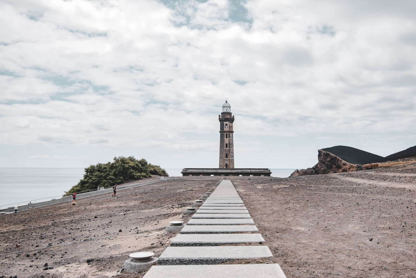
On September 27, 1957, a submarine volcanic eruption began off Faial's western tip, near the Capelinhos lighthouse. What followed was one of the best-documented geological events of the 20th century: for 13 months, until October 24, 1958, the volcano alternated between explosive and effusive phases, first forming an 800-meter-wide islet that fused with Faial on November 12, 1957, via an isthmus of ash and scoria.
| Capelinhos Eruption | Fact |
|---|---|
| Started | September 27, 1957 |
| Ended | October 24, 1958 |
| Duration | 13 months |
| Deaths | 11 |
| People displaced | around 1,500 |
| Working population emigrated | around 40% |
The human toll was severe: 11 deaths, roughly 1,500 people displaced, and hundreds of homes destroyed or rendered unlivable by falling ash. In the years that followed, nearly 40% of Faial's working population emigrated, most to the United States — an exodus so significant that the US Congress passed the Azorean Refugee Act of 1958, easing entry for thousands of Azorean families displaced by the eruption. It's one of the direct roots of today's large Azorean-American community across New England.
Visiting Today: The Interpretation Centre and the Half-Buried Lighthouse
The Capelinhos Volcano Interpretation Centre, opened in 2008, was built literally inside the base of the old lighthouse — now half-buried under compacted volcanic ash. The underground museum blends geology, oral history, and a climb to the top of the lighthouse itself, overlooking the entire lunar landscape the eruption created. It's, without exaggeration, one of the most striking museum experiences anywhere in the Azores.
The Caldeira do Faial: Hiking to the Island's Rooftop
At the island's geographic center sits the Caldeira do Faial, a volcanic crater roughly 1.5 km across and 400 meters deep, covered in dense vegetation and frequently wrapped in cloud. A circular trail of around 11 km follows the crater rim, alternating views over the caldeira's green interior and out to the open Atlantic — on clear days, you can see Pico, São Jorge, and Graciosa all at once. The full loop takes 3 to 4 hours and requires no technical experience, just solid footwear and a waterproof layer, since the island's summit draws fog even on days that are sunny at sea level.
Whale Watching & Marine Life off Faial
The channel between Faial and Pico is one of the busiest cetacean corridors in the North Atlantic, thanks to the sharp drop-off just offshore. Sperm whales are spotted nearly year-round, while peak season for baleen whales — blue, fin, and humpback — runs from April to June during the spring migration. Alongside Pico, Horta is the main departure point for whale-watching boats in the Central Group.
Beaches, Viewpoints & the Botanic Garden
Praia do Porto Pim
Just a short walk from central Horta, this sheltered golden-sand bay is one of the few true sand beaches in the Azores, with calm water perfect for swimming even when the rest of the coastline is choppy.
Monte da Guia and the Old Whaling Factory
This protected landscape south of Horta pairs an old volcanic cone with the repurposed buildings of a 20th-century whaling factory, now an interpretation center on the industry that shaped Faial's economy until whaling was banned in Portugal in 1984.
Espalamaca Viewpoint
Atop the headland north of Horta, beside the statue of Nossa Senhora da Conceição, this viewpoint delivers one of Faial's most photographed views: the bay of Horta, its marina, and Pico's unmistakable silhouette beyond.
Faial Botanic Garden
Open to the public since 1986, this garden houses the Azores Seed Bank and is the easiest place on the island to get up close with Macaronesian endemic flora before — or after — spotting it in the wild up in the Caldeira.
Getting to Faial & Getting Around
Horta Airport (HOR) receives regular Azores Airlines flights from Ponta Delgada (about 50 minutes) and other Central Group islands. If you're already island-hopping the Triangle, Atlânticoline's Blue Line connects Horta to Madalena, on Pico, in just 30 minutes, with multiple daily crossings year-round from around €8 per person. On the island itself, renting a car is by far the most practical way to reach the Caldeira and Capelinhos, since public transport mostly serves the Horta–airport corridor.
When to Visit & How Many Days to Plan
Peak ferry season and peak hydrangea bloom overlap between June and September, making this the most popular — and most weather-reliable — window to visit Faial. Plan on at least 2 to 3 full days: one for Horta and the Caldeira, one for Capelinhos and the west coast, and a third, if possible, to add Pico via the Blue Line.
Practical tips:
- Pack a windbreaker even in high summer — the Caldeira's rim has its own microclimate.
- Book your Pico ferry in advance during July and August.
- Visit the Capelinhos Interpretation Centre early in the day to avoid tour groups.
- Leave your own painting on Horta's marina — it's tradition, not an obligation, but the experience is worth it.
Frequently Asked Questions
How many days do you need to visit Faial?
Two to three full days are enough to see Horta, the Caldeira, and Capelinhos Volcano at a relaxed pace, especially if you pair the visit with a crossing to Pico.
Why is Faial called the "Blue Island"?
For the sea of blue hydrangeas that blooms along its roads and stone walls between June and September — one of the most iconic sights in the Azores.
Is it safe to visit the Capelinhos volcano area?
Yes. The area has been inactive for decades and is now a geological park with marked trails and the Interpretation Centre, entirely safe for visitors of any age.
Is the full Caldeira hike worth doing?
Yes — it's one of the best hikes in the Azores for anyone with a moderate fitness level, with no serious technical difficulty, though you should pack for wind and fog.
How do you get from Horta to Pico?
Via Atlânticoline's Blue Line, with frequent year-round crossings and a crossing time of just 30 minutes between Horta and Madalena.
Final Thoughts
In just over 170 km², Faial condenses the maritime, geological, and human history that defines the Azores: yachts that have crossed the Atlantic for a century, a volcano that redrew the coastline in 1957 and 1958, and a caldera that still shapes the island's climate and landscape. To round out the trip, take the 30-minute crossing to Pico and its UNESCO vineyards, plan your route with our complete Azores island-hopping guide, book a sailing tour of the Azores, join a whale-watching trip in the Faial-Pico channel, or dig deeper into the archipelago's volcanic story in our guide to the Azores' volcanic caves.