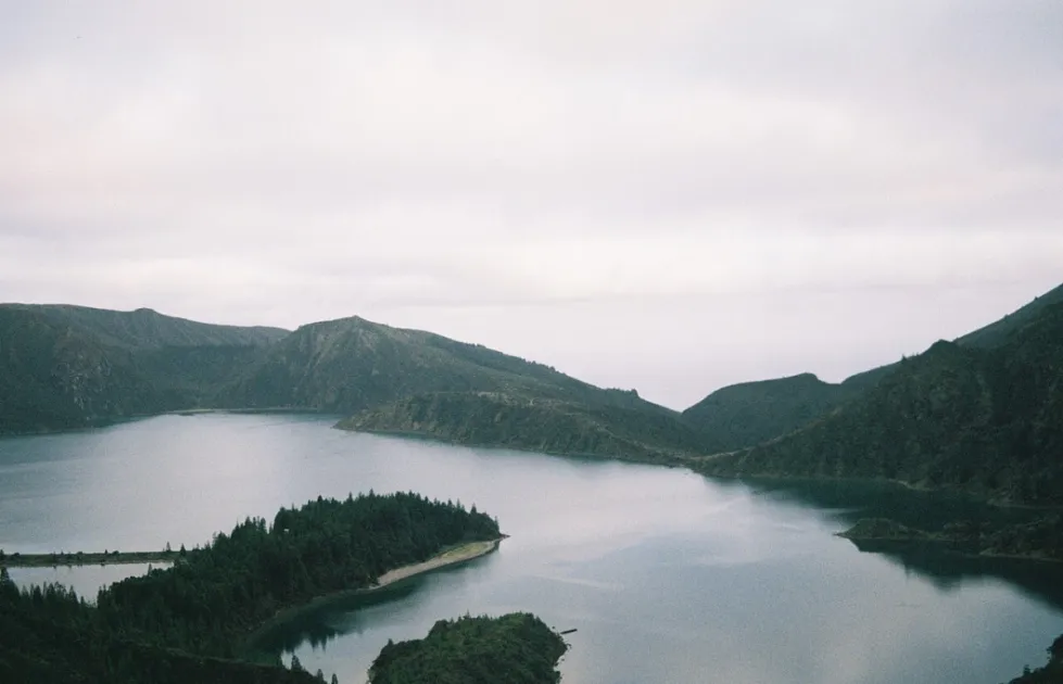
Lagoa do Fogo is the crater lake that many visitors to São Miguel put at the top of their list, and with good reason: it lies inside an extinct volcano in the middle of the island and has been protected as a nature reserve since 1974. Getting there is no longer as simple as pointing the rental car uphill, though, because access rules change with the season.
This guide gathers what is confirmed about access, the two roadside viewpoints, the marked PRC02 SMI walking trail and the rules of the reserve. Where a detail could not be confirmed, we say what to check and where, so you can plan with up-to-date information.
Overview
Lagoa do Fogo (literally "Lake of Fire") lies at the bottom of the crater of an extinct volcano, within the large volcanic massif of the Serra de Água de Pau. It is the highest lake on the island, at about 575 metres above sea level, and also one of the largest: roughly 3.2 km long and 2.4 km wide, with a total area of 136 hectares.
Its protection dates from 1974, when it became a nature reserve, which explains both the rules below and the wild feel of its shores. In 2012 the Praia da Lagoa do Fogo was recognised as one of the 7 Wonders of Portugal in the "wild beach" category. That title does not change the rule on the ground: bathing is not allowed.
Getting there
Access depends on the time of year. According to a 2026 update from São Miguel Guide, during the summer months, from mid-June to the end of September, the road to Lagoa do Fogo is served only by bus between 9:00 and 19:00. Outside those hours it is possible to arrive in a private vehicle.
If you use the bus, the ticket costs 5 euros per person and is free for children under 6 and for residents. You can buy it online on the official Lagoa do Fogo website or directly on the bus. The ticket is valid for the whole day and lets you get on and off at the different stops along the route, as long as you do not restart the journey at the same stop. The same website has a map of the stops.
From the sources we consulted we could not confirm what applies outside the summer period, nor the bus timetables and frequency. Before you go, check the official website and, if in doubt, ask a local tourist office. Rules of this kind can change from one year to the next, so treat the summer details above as the situation reported for 2026, not as a permanent guarantee.
If you have no car, or simply prefer a guide, organised day tours from Ponta Delgada combine Lagoa do Fogo with Sete Cidades; our guide to day trips from Ponta Delgada explains the options. If you are building a longer drive, see the 7-day São Miguel road trip itinerary.
Viewpoints
You do not have to walk to enjoy the lake. São Miguel Guide recommends two roadside viewpoints for a good panorama: the Miradouro do Pico da Barrosa and the Miradouro da Lagoa do Fogo. Both give you the crater and its water without any effort beyond the drive or bus ride.
The view is wonderful only if the weather and the mist allow it, and that is the main uncertainty of any visit. At 575 metres the lake sits well above the coast, so mist is a real possibility: check the forecast on the day and, if the crater is full of cloud, consider waiting or coming back later. More options are listed in our viewpoints section and on the São Miguel island page.
The PRC02 SMI trail
The classic way to reach the shore is the PRC02 SMI trail, "De Praia a Lagoa do Fogo". The official trail sheet (Azores Trails, São Miguel Natural Park) gives 11 km and about 4 hours, and its profile climbs from about 200 m at the start to roughly 540 m before returning the same way. São Miguel Guide classes it as medium difficulty, very well signposted and not crowded; since cars cannot reach this shore, you may have it almost to yourself.
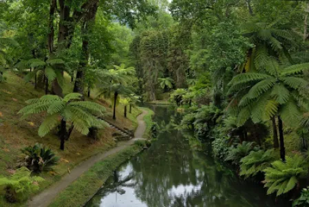
The route begins on a dirt track through farmland and pasture. On the climb you pass the ruins of an old factory that made fibre from an introduced plant, New Zealand flax (Phormium tenax). At a fork you keep right through a Japanese cedar (Cryptomeria japonica) wood and reach a levada, an irrigation channel, which the trail follows. The sheet warns of muddy stretches along it and advises proper footwear.
Along this part you can see endemic plants such as the Azorean blueberry (Vaccinium cylindraceum), Azorean heather (Erica azorica) and Viburnum treleasei. After a dam the path enters the valley of the Ribeira da Praia, an open area with large slopes and several water collection points; the works began in 1984 to capture springs fed by the natural filtering of the lake and were completed in 1998. At the shore the sheet advises caution because of a gull colony. The way back takes in the view over the south coast, with the islet of Vila Franca standing out.
A shorter route listed on AllTrails
AllTrails lists a separate, much shorter route called "Trilho da Lagoa do Fogo": 1.6 km, 115 m of elevation gain and an estimated 30 to 60 minutes, rated moderate. When we consulted it, the page carried a closure alert, while a hiker review dated October 2026 reported no sign or official indication of a ban. Treat its status as unconfirmed and check on site or with the local authorities before relying on it.
Rules of the reserve
Lagoa do Fogo is a nature reserve, and the rule every visitor needs to know is simple: bathing is not allowed. The trail takes you to a shore that cars cannot reach, so you may well enjoy it in solitude or with very few people; that is a good reason to leave nothing behind and to keep to the paths.
Two cautions come from the official trail sheet: wear proper footwear because of the mud along the levada, and be careful near the lake shore because of the gull colony, which is territorial especially in the nesting season, April and May. The sheet also lists emergency contacts and the national emergency number; note them before you set out, and remember that the European emergency number is 112.
Planning your visit
Plan the day around the access rules and the weather. In summer, decide whether you will use the bus (9:00 to 19:00) or arrive outside those hours in your own vehicle, and check the official website for the stop map. For the PRC02 SMI allow around 4 hours for the walk itself, plus time at the lake and the viewpoints.
Bring footwear suited to mud, layers for changing weather at altitude and enough water. We cannot confirm mobile coverage on the trail, so download the map beforehand. For more walks across the archipelago, see the 10 best Azores hiking trails and the trails section.
FAQ
Can you swim in Lagoa do Fogo?
No. It is a nature reserve and bathing is not allowed.
How do I get to Lagoa do Fogo in summer?
According to a 2026 update, from mid-June to the end of September access is by bus only, between 9:00 and 19:00; outside those hours private vehicles can go. Confirm the current rules on the official website before travelling.
How much is the bus ticket?
5 euros per person; free for children under 6 and for residents. It is valid all day and lets you get on and off at the stops, provided you do not restart the journey at the same stop.
How long is the PRC02 SMI trail?
The official sheet gives 11 km and about 4 hours for the out-and-back route from Praia to the lake shore. São Miguel Guide rates it medium difficulty.
How big is Lagoa do Fogo and how high is it?
It lies at about 575 metres, is roughly 3.2 km long and 2.4 km wide, and covers 136 hectares. It has been a nature reserve since 1974.
Final thoughts
Lagoa do Fogo rewards visitors who prepare: a viewpoint on a clear day, a signposted trail to a quiet shore and a reserve that asks little in return, namely no bathing, proper footwear and respect for the nesting gulls.
Because access rules have changed with the seasons, confirm the current arrangements on the official website before you leave and use this guide as a starting point rather than a timetable. For wider planning, start from the São Miguel island page.